
Charlotte County Emergency Management
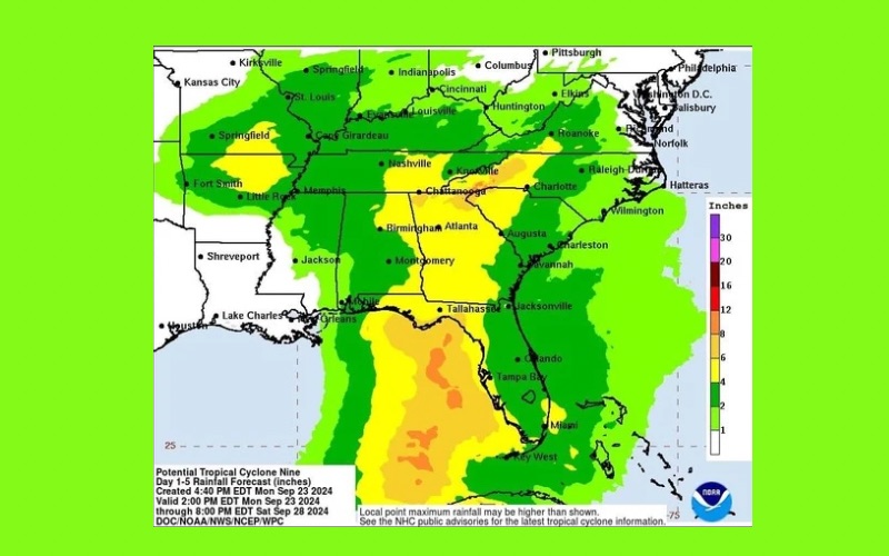
Sept. 23 Early Evening Update | Potential Tropical Cyclone 9 is expected to intensify overnight and become Tropical Storm Helene and is now expected a become a major hurricane before landfall in the Big Bend area. Tropical Storm, Hurricane and Storm Surge Watches and/or Warnings are likely to be issued overnight or early tomorrow (Tuesday) for portions of the Florida west coast. Additional changes to the forecast are to be expected as the circulation becomes better defined. Please keep in mind this is expected to be a large storm with Tropical Storm winds extending 200+ miles from the center, so please do not focus on the forecast cone.
As we monitor the development of Potential Tropical Cyclone 9, here’s what we could experience in our area:
🌧 Widespread heavy, potentially flooding rainfall. 5” to 10” area wide possible.
🌊 Storm Surge and coastal flooding likely, though extent of surge is not known at this time. Extremely hazardous marine conditions and rip currents can be expected Wednesday through Friday.
💨 Strong, potentially damaging winds possible beginning late Wednesday through late Thursday.
🌪 Isolated waterspouts or tornadoes are possible.