
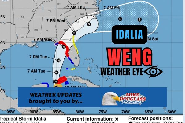
..STORM SURGE AND HURRICANE WARNINGS ISSUED FOR PORTIONS OF THE WEST COAST OF FLORIDA… …LIFE-THREATENING STORM SURGE AND DANGEROUS WINDS BECOMING INCREASINGLY LIKELY FOR PORTIONS OF FLORIDA…
WATCHES AND WARNINGS
——————–
CHANGES WITH THIS ADVISORY:
-A Storm Surge Warning has been issued from Englewood northward to
the Ochlockonee River, including Tampa Bay.
-A Hurricane Warning has been issued from the Middle of Longboat Key
northward to the Ochlockonee River, including Tampa Bay.
-A Tropical Storm Warning has been issued from Chokoloskee northward to the Middle of Longboat Key, and from west of the Lockheed River westward to Indian Pass.
-A Storm Surge Watch has been issued from Mouth of the St. Mary’s River to Altamaha Sound, Georgia.
-A Tropical Storm Watch has been issued for the Atlantic coast of Florida and Georgia from Sebastian Inlet, Florida northward to Altamaha Sound, Georgia.
The track models have bunched up again overnight and the cone of uncertainty has shifted a bit W, taking the mouth of Tampa Bay out of it. The NHC track has also moved a few miles up the Florida West Coast. That doesn’t change a whole lot in terms of impacts, but at least they aren’t any worse. The HURRICANE WARNING is posted from the middle of Longboat Key and then N along the West Coast. Local and State officials are now staffing Emergency Operations Centers and providing guidance regarding any recommendations for protective measures you should take depending on your location. Once again, there is no one alive that can tell you how much wind, rain or storm surge you might expect at your home. That would be like throwing darts from across a room and hoping to hit the bullseye! You also must KNOW YOUR ZONE and have your alerts function active on your phone. Listen to local radio stations for official announcements and most of all: STAY CALM!